Guam and Northern Marianas face flooding, downed power lines after Super Typhoon Bavi
Super Typhoon Bavi knocked down power lines and caused flooding across Guam and the Northern Mariana Islands, adding to recovery from an earlier storm.
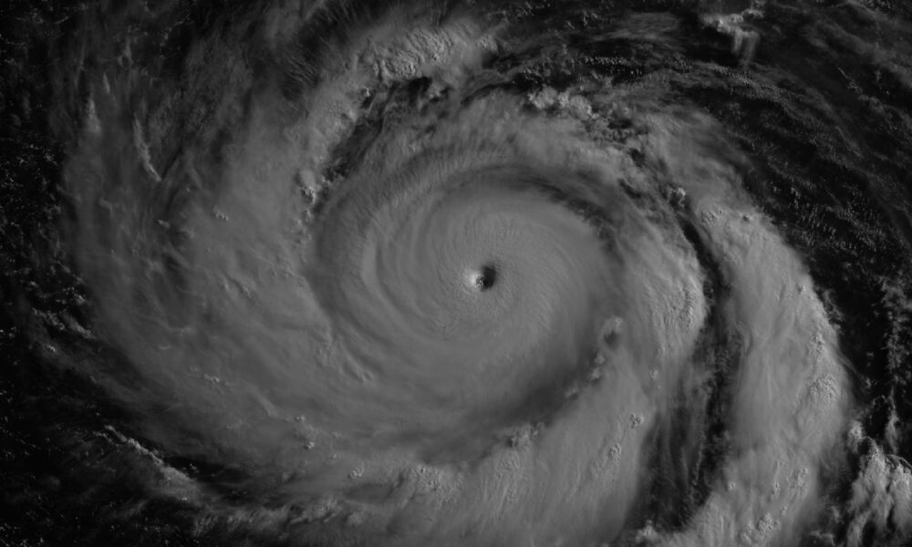
While satellite images showed Super Typhoon Bavi as a remarkably organised storm from space, communities across Guam and the Northern Mariana Islands faced a much harsher reality on the ground. According to NASA, powerful winds knocked down power lines and poles, while flooding and storm debris affected roads across several islands, with buildings also suffering damage, including infrastructure linked to water distribution on Rota.
Emergency crews spent days responding to the aftermath, and the U.S. Coast Guard worked to remove navigation hazards and help restore access to ports once sea conditions became safer. The recovery effort came only weeks after residents had dealt with Super Typhoon Sinlaku, another destructive storm that struck the same region in April.
Bavi reached super typhoon status on July 4 local time, with sustained winds climbing to around 290 kilometres per hour as it approached the islands — becoming the third Category 5 tropical cyclone of 2026, fuelled by sea surface temperatures of around 30 degrees Celsius along its path.
By July 8, Bavi remained a formidable system despite gradual weakening, with satellite imagery showing it moving west across the Philippine Sea southeast of Taiwan and maximum sustained winds still estimated at around 250 kilometres per hour, with forecasts suggesting it could curve towards Taiwan, the Ryukyu Islands and parts of mainland China.



Leave a Reply